|
|
 |
|
What is a
GIS?
"GIS is an
integrated system of computer hardware, software, and trained
personnel linking topographic, demographic, utility, facility,
image and other resource data that is geographically
referenced." - NASA
This is
probably the most asked question posed to those in the
Geographic Information Systems (GIS) field and is probably the
hardest to answer in a succinct and clear manner.
A
Geographic Information System (GIS) is a modern term that
refers to a system of database that can be linked to a digital
map. In the early days of map making, information included by
cartographers were limited by the space of their paper maps.
Only so much information could be printed onto a piece of
paper. You either must have a very large piece of paper or a
very fine tip pen to write very small letters to include all
the geographic information. Data on these analog maps were
also difficult to update because of the time and labor needed
in drawing and data gathering. With the advent of the digital
era, the amount of data that a computer generated map may
contain is now limited by the storage capabilities of today's
computers. Drawings on maps need not be updated regularly
since terrain features generally remain the same over periods
of years. It was only the information that are linked to the
map that requires constant updating. Digital maps today do not
just contain road lines and city capitals. They can be linked
and cross-referenced to a variety of databases that contain
information needed by different fields of
endeavors.
The capabilities of GIS are a far cry from
the simple beginnings of computer cartography. At the simplest
level, GIS can be thought of as a high-tech equivalent of a
map. However, not only can paper maps be produced far quicker
and more efficiently, the storage of data in an easily
accessible digital format enables complex analysis and
modeling not previously possible. The reach of GIS expands
into all disciplines and has been used for such widely ranged
problems as prioritizing sensitive species habitat to
determining optimal real estate locations for new businesses.
The key word to this technology is Geography - this
usually means that the data (or at least some proportion of
the data) is spatial, in other words, data that is in some way
referenced to locations on the earth. Coupled with this data
is usually data known as attribute data. Attribute data
generally defined as additional information, which can then be
tied to spatial data. An example of this would be schools. The
actual location of the schools is the spatial data. Additional
data such as the school name, level of education taught,
school capacity would make up the attribute data. It is the
partnership of these two data types that enables GIS to be
such an effective problem solving tool.
GIS operates
on many levels. On the most basic level, GIS is used as
computer cartography, i.e. mapping. The real power in GIS is
through using spatial and statistical methods to analyze
attribute and geographic information. The end result of the
analysis can be derivative information, interpolated
information or prioritized information.
Some practical
uses of a GIS can be found in:
- Tax, Business & Licensing Office of
Local Government Units
- Emergency Planning & Disaster
Prevention
- Real Estate Parcel Management
- Real-Time Asset & Vehicle Tracking
via GPS Navigation Equipments
- Drainage and Flooding Analysis Using 3D
Terrain Data
- Demographic Analysis For Proper
Resource Allocation
- Marketing Analysis For Product Sales
Distribution
- Telecommunication Grid Network System
Planning
Copyright of
portions of this article are printed with permission from GISLounge.
Complete
article can be found here.
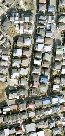
Some
images on this site are compiled from the NASA Earth Image
Library.
Web images on this site are compiled from SXC website.
» back to
top
|
|