Our
Projects
|
|
|
|
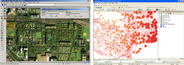
Digital Road Atlas
of Singapore
Preparation
of a street level network and buildings database from
a high resolution SPOT image covering the entire Island
of Singapore. Work covered orthophoto generation from
SPOT 5 Satellite Imagery, road network and POI encoding
and verification, GPS point accuracy verification
and preparation of road atlas imagery. The digital
atlas contains more than 5000 buildings complete with
address, postcode and establishment name. The final
digital maps needed to be GPS grade accurate because
this will serve as a basis for an Asset Management
and Tracking System based on GPS Navigation equipments.
» back
to top
|
|