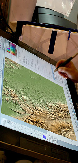
Raster-Vector
Conversion Map Digitizing
Information contained in analog maps have a limited
use in today’s business environment. With the increasing
use of the Internet in ordinary commerce, everything
has to be in a digital format. Our rapidly growing
company uses a variety of advance technologies to
convert paper-based maps, aerial and satellite photography,
tax and property records, population statistics
and other “geo-linked” data into a vector drawing
system or other widely used CAD format. Conversion
of paper maps into digital data is done either through
the use of flatbed digitizing boards or by using
a scanned image (raster data) of the source as an
overlay image on our CAD System.
Computer
Aided Design Mapping
Majority of today’s leading engineering and architectural
firms prepare their drawings and plans in CAD format.
CAD applications like MicroStation or AutoCAD have
become industry standards for various engineering
fields. These applications have become the base
platforms for add-on applications in civil design,
land survey, digital terrain modeling (DTM), digital
mapping, photogrammetry, etc. Using a CAD-based
application provides an accurate and cost-effective
way of presenting engineering drawings and design
plans.
Geodetic Engineering & Land Survey
Our company offers all types of Land Surveying & Geodesy related
services. We have the equipments & expertise to carry out the following
services - Topographic Survey, Detailed Engineering Survey, Relocation Survey,
Hydrographic Survey, GPS Network Control, 1st Order Leveling, Road & River
Cross-section & Alignment Survey, Bridgesite Survey, Parcellary Mapping,
Cadastral Survey, Mining Survey & Construction Survey. Our Survey Party are equipped
the latest Digital Total Station, Dual & Single Frequency GPS Receivers and Digital Level.
Geographic
Information System (GIS)
Land Information System (LIS)
A GIS is sometimes referred to as a “graphical database”.
It is a powerful analytical tool that can easily
present a huge amount of related data to a given
locality usually in the form of a map. It has the
ability of linking different types of data to answer
complex geographical queries. Unlike paper maps
however, data in this format can easily be updated
and introduced into the GIS database on a regular
basis. This flexible characteristic of a GIS makes
it useful for users in a broad range of profession.
Ideal for real estate managers that need easy access
to land parcel information found in Site Development
Plans.
Orthophoto Generation
Digital Photogrammetry
Images of the earth as viewed from above provide
an efficient source of geographic information. Contained
in these images are data, which are of importance
to various fields of business. Urban planning, environmental
conservation, governmental and economic policies
can be derived through the proper analysis of the
information contained in these images. Using the
latest GIS softwares we can take raw aerial and
satellite images and produce Rectified Imagery &
Ortho Photo Mosaics. These images are corrected
for any distortions from terrain and sensor induced
errors and are considered map accurate.
A-Map
GPS Navigation Tracking System
Using our georefernced digital maps and viewer,
users can connect a portable GPS NMEA System GPS
device to their laptop PCs and have a mobile navigation
system. Our AMAP system is primarily used for marketing
& research projects. It contains thousands of
Points of Interests (POI) of Metro Manila overlayed
on a detailed street map of the Metropolis.
3D
Solid Modelling Architectural Walk Throughs
Need a 3D model from a 2D drawing? We can prepare
a 3D model of your drawings in 3DS, DWG, DGN. Once
converted to a 3D model, the user can rotate, pan,
zoom and observe the model from any angle and position.
Create fly-by animations from your 3D models for
presentation purposes.
» back to top